
Geospatial data is an overlooked tool that can significantly improve cybersecurity efforts. How can location-specific information stop cyber attacks and deter cybercriminals?
What Is Geospatial Data?
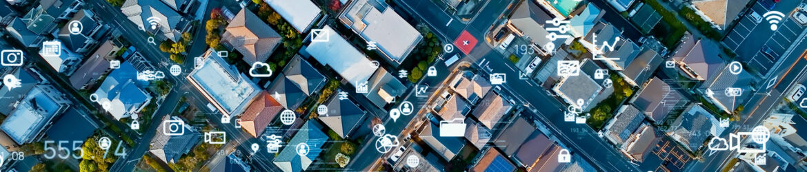
Geospatial data is location-related information about individuals, objects or events. The most common examples are demographic details, addresses, transportation networks and satellite imagery. Although geospatial data may not seem as advantageous as other modern security tools, it has its appeal. In fact, spatial analytics had a market value of $88.3 billion in 2020. While it isn’t a standard cybersecurity instrument, its use cases are expanding as it becomes more popular.
There are two main ways geospatial data is represented. The first one — vector — uses polygons, lines and points to visualize a location. It relies on vertices and paths and stores information as XY coordinates. The second one — raster — uses pixels of equal dimensions.
A geospatial information system (GIS) is one of the leading technologies for this type of data. It’s a computer system for capturing, storing, analyzing and visualizing geographic details. IT teams often leverage it after using satellites, surveys and sensors to collect relevant information.
Geospatial Data’s Role in Cybersecurity
In cybersecurity, geospatial data tells where and when threats are coming from. IT teams can pinpoint cybercriminals’ positions using timestamps and location details. This insight is crucial because it helps them decide where to focus their efforts.
Geospatial data is essential in the context of remote work and devices. IT teams that have to protect telecommuters’ computers and Internet of Things (IoT) technology would substantially benefit from being able to review location-specific logs. This level of detail helps them identify suspicious activity sooner, enabling them to respond faster.
Examples of Geospatial Data in Cybersecurity
Multiple examples of geospatial data being used for cybersecurity exist.
Smart Cities
Smart cities can use geospatial data to track hackers’ locations, which helps them respond faster. They can also see which parts of their internet-connected infrastructure are affected, enabling them to reroute traffic or turn off devices to minimize the impact of cyber attacks.
Governments
Local, state and federal governments use geospatial data. For instance, the National Geospatial-Intelligence Agency uses it to improve national security and enhance intelligence. While agencies’ methods vary, they share the same goal — they all aim to use real-time location information to respond to threats.
Companies
Brands can use geospatial data to track their employees’ whereabouts on the clock. Also, they can monitor when and where devices connect to their systems. This way, they can identify and respond to insider threats and unauthorized access attempts faster.
How Does Geospatial Data Improve Cybersecurity?
Geospatial data strengthens cybersecurity in multiple ways.
- Increases IoT Visibility
The number of IoT cyber attacks has risen significantly recently. In fact, it increased to 112 million in 2022 — up 80 million from the previous year. Geospatial data is one of the emerging solutions to this growing issue because it improves visibility.
With geospatial data, IT professionals can track and map every IoT device connected to their network. If a new one suddenly appears in an unfamiliar area, they can flag it as suspicious, and prevent it from transferring or receiving information.
- Uncovers Hidden Trends
Geospatial data gives IT teams insight into where cyber attacks come from and how often they occur, making predictions by uncovering trends. Overlaying location details on top of cyber attack information reveals hidden patterns they can use to anticipate future threats.
- Enables Endpoint Tracing
When IT teams monitor where and when endpoints — devices connected to and exchanging data with a computer network — link to their system, they can uncover suspicious activity. For example, they can tell which remote worker is an insider threat by reviewing the location of each instance of access.
- Improves Access Controls
IT teams can use geospatial data to create a virtual boundary, automatically approving or denying requests depending on where employees try to access sensitive or proprietary documents. Someone with authorization at work doesn’t need to have it at home.
This virtual boundary improves cybersecurity by strengthening access controls. If staff can only read or edit sensitive data at work or in their home offices, the risk of insider threats and credential attacks significantly lowers.
Obstacles Limiting The Potential of Spatial Analytics
Although leveraging geospatial data for cybersecurity purposes is promising, a few things hold it back. The first is information security — storage systems have to be breach-resistant. If IT teams don’t secure their databases well enough, hackers could learn the exact location of remote workers and IoT devices.
Another one of the main obstacles is privacy. In all likelihood, remote workers won’t be thrilled having their location tracked in real-time. Even putting aside potential security issues that could leak their personal information to hackers, many will be uncomfortable with this level of scrutiny.
Most people don’t like being watched while working. In fact, 59% of remote workers say they feel stressed about workplace surveillance. Although their feelings about geospatial data collection won’t necessarily impact cybersecurity, their hesitation may hurt adoption rates.
How Geospatial Data Will Be Used for Cybersecurity
As geospatial data increases in popularity, its impact on cybersecurity will become apparent. IT teams can easily overcome privacy and security obstacles are serious concerns with enough effort.

As the Features Editor at ReHack, Zac Amos writes about cybersecurity, artificial intelligence, and other tech topics. He is a frequent contributor to Brilliance Security Magazine.
.
.
Follow Brilliance Security Magazine on LinkedIn to ensure you receive alerts for the most up-to-date security and cybersecurity news and information. BSM is cited as one of Feedspot’s top 10 cybersecurity magazines.